Waterford City
Getting around Waterford
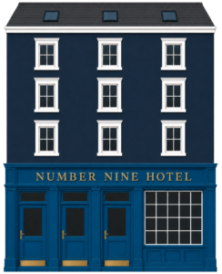
Number Nine sits right on Merchants Quay in the heart of the city, so most of Waterford is on your doorstep. The bus station is a couple of blocks along the quay, under a 5 minute walk, and Plunkett train station is just across the bridge, about a 7 to 10 minute walk. Here is everything you need to travel by bus and train, with a live map.
Bus station Merchants Quay · under 5 min
Train station across the bridge · 7–10 min
City centre everything within a 10 min walk
Live bus
Live train
Waterford city bus routes
TFI city services, operated by Bus Éireann. Tap a route to see all its stops and trace its line on the map.
- The Clock Tower
- Merchants Quay
- City Centre
- SETU (Cork Road)
- Ardkeen
- University Hospital Waterford
- The Clock Tower
- Meagher's Quay
- City Centre
- SETU (Cork Road)
- The Clock Tower
- St John's Park
- Meagher's Quay
- Peter Street
- City Centre
- SETU (Paddy Browne's Road)
- University Hospital Waterford
- City Centre
- Oakwood
- Waterford City
- Merchants Quay
- Tramore Bus Station
Trains from Plunkett Station
Plunkett Station is just across the bridge. Direct services run to Dublin Heuston via Kilkenny and Carlow.
Waterford ↔ Dublin Heuston
Next trains at Waterford's Station
Checking live times…
Intercity coaches
Longer trips by coach from Waterford.
4
Waterford ↔ Dublin (Expressway)via Kilkenny, Carlow, Dublin Airport · Bus Éireann Expressway
40
Waterford ↔ Corkvia Dungarvan, Youghal, Midleton · Bus Éireann
370
Waterford ↔ Dungarvanvia Copper Coast · Bus Éireann
X7
Waterford ↔ Dublin (Citylink/Dublin Coach options)via Carlow, Dublin · TFI / private
Good to know
- TFI Leap Card gives cheaper fares on buses and trains. Tap on and off, or buy single tickets from the driver.
- TFI Live and the TFI Go app show real-time departures for every stop in the country.
- Taxis rank on the quay near the Clock Tower, a short walk from the hotel.
- Walking is often quickest in the compact city centre, with the Viking Triangle, shops and restaurants all within about 10 minutes.